Snowline Elevation Dynamics @ DLR
01 October 2021
Landsat-based Analysis of Snowline Elevation Dynamics
This project is a work contract with the DLR, which aims to implement a novel approach to accurately detect long-term snow cover dynamics in the European Alps, as the previous approach is prone to errors from cloud cover.
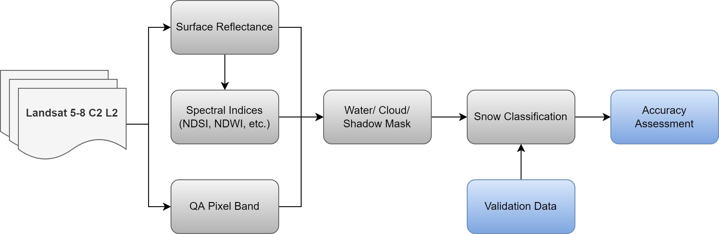
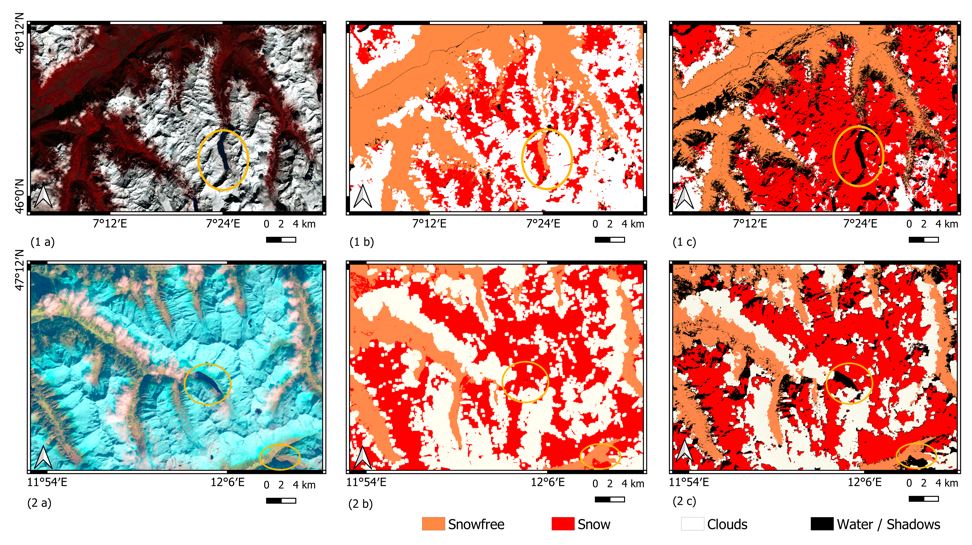
The previous research has revealed the challenges in excluding clouds from snow detection due to their comparable spectral signature when computing NDSI. To better quantify the changes in long-term snowline elevation, I worked with Landsat imagery to develop an optimized snow classification scheme for long-term data analysis between 1985 to 2020 (Landsat 5, 7 & 8), which applies a novel cloud filter to effectively distinguish snow cover from other classes, resulting in more accurate retrieval of snowline elevation. Besides, an automated data pipeline is developed to streamline the ETL and multiclass classification processes. The optimized workflow has been thoroughly validated in European Alps using Sentinel-2 imagery with approximately 100,000 data points, illustrating the significant increase in classification performance from overall 77.61% to 87.5% (Landsat 5), 95.5% (Landsat 7 ETM+), and 94.5% (Landsat 8 OLI) compared to the previously published methodology. The classified scheme has been applied and published in MDPI.